Decision support system
Through an accurate description of the dynamics taking place in the city and to in-depth and certified analyses, we support public administrations in their everyday decisions.
Real-time management of processes and information
Our decision support systems exploit multiple data sources (sensors, satellites and applications) to simplify city administration activities, from daily activities to long-term strategic choices. In addition to improving the quality of urban planning, public policies and operational management of administrative processes, these tools make it possible to optimize costs and times for the Public Administration.
Times and sources of data
Our solutions can provide support in two distinct time horizons:
In real time, thanks to data collection processes for immediate use;
In the long term, thanks to advanced analysis and correlation of the collected data.
Our tools are designed to integrate and correlate different data sources:
Data from social media and public or third party applications;
Data extracted from public databases (open data) and statistical or cartographic sources;
Data collected from satellites, sensors and IoT systems;

Situation Room
Immediacy and ease of use are essential in the management of emergency situations or major events.
Monitoring in real time what is happening in a given context, managing unexpected situations and being informed of the reactions of those who are in those places, are all factors that can be analysed and managed through the Situation Room platform. It is possible to integrate information from different sources, including IoT sensors, social networks and other applications of the WiseTown suite, linked to a specific city scenario.
Geoanalytics
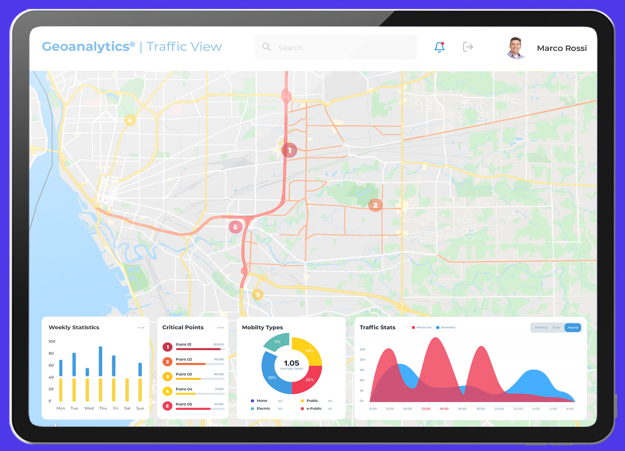
Thanks to the analysis of various satellite, municipal and IoT sensor data sources, it is possible to have an extremely precise picture of territorial dynamics. Through GeoAnalitics the information can be managed and displayed in a simple and intuitive way. The system processes and relates large amounts of heterogeneous data from different sources, the results can be consulted through simple dashboards capable of analyzing the evolution of phenomena in relation to time and territory, thus also revealing correlations that otherwise would not be evident.
Thematic Dashboard
Environment, Health, Mobility, Urban Buildings, are just some of the issues that can be analyzed and kept under control thanks to this tool.
The goal is to provide clear analyzes and views on a specific aspect, through the integration of satellite data and open data. It is possible to purchase one or more thematic dashboards relating to particular areas, customizing the data and analyzes reported. This tool, thanks to the addition of data from the public administration, flows into Geo Analytics.
Who is it for?

Public Administrations that want to monitor and control emergency situations and major events.

Municipalities that have as their objective an accurate and careful planning of the territory, supported by a thorough and certified knowledge of the dynamics in place.
Who is it for?

Public Administrations that want to monitor and control emergency situations and major events.

Municipalities that have as their objective an accurate and careful planning of the territory, supported by a thorough and certified knowledge of the dynamics in place