
Two Urban Observatories
The GAIA (Green Areas and Seismic Observatories) Project was created with the aim of developing two state-of-the-art observatories: the Urban Seismic Observatory and the Urban Green Areas Observatory. These are innovative tools that will revolutionize land management and monitoring, putting technology at the service of cities. At the heart of the project is the WiseTown platform, which will integrate the data collected by the Observatories into the digital twin of the City of Perugia. Through an intuitive interface and cutting-edge analysis tools, it will be possible to monitor information in real time and receive alerts in the event of emergencies or critical situations.
Green Areas Observatory
For the protection of green heritage
The Green Areas Observatory is designed to monitor tree stability and the risk of hydrogeological instability, contributing to the safety and quality of the urban environment. Imagine a majestic tree in the middle of a public park: thanks to the use of advanced sensors, it will be possible to assess its stability and intervene promptly in case of critical issues. In addition, this technology will make it possible to identify risk situations, such as landslides in hilly areas.
It is not just a matter of preventing dangers, but also of improving the livability of cities. The Observatory will analyze fundamental parameters, such as air quality and noise pollution levels, providing essential data for the protection and enhancement of natural heritage.

Urban Seismic Observatory
A response to areas highly exposed to seismic risk
The Urban Seismic Observatory, on the other hand, will be a concrete response to the challenges posed by areas highly exposed to seismic risk. This tool will allow for continuous monitoring of the condition of buildings and infrastructure, identifying those buildings that require the most urgent inspection after earthquakes. Specifically, in the event of an earthquake, the Observatory will provide rapid and detailed analyses to facilitate emergency response, reducing response times and accelerating the return to normality. Take, for example, a bridge or a school: thanks to integrated sensors, it will be possible to immediately detect any structural damage or confirm the safety of the structure. This system will not only optimize response times in emergencies, but will also contribute to a significant reduction in the costs and time required for post-earthquake restoration operations.


Minimizing the impact of environmental risks
Real-time environmental monitoring and digitized approaches
Recently, there has been a growing need, focus, and awareness of the implementation of a strategy for assessing the health of structures (structural monitoring, SHM – Structural Health Monitoring), hydrogeological instability, and the health of urban green areas. This is due to the maintenance nature of these areas, but even more so for reasons related to the safety and usability of buildings and areas by people. These processes involve the periodic observation of certain parameters and a platform on which to display and analyze the data.

GAIA Project
The role of technology
The two Urban Observatories will integrate data collected by WisePower sensors—advanced and completely wireless—along with data from other sources, including: Earth observation, LiDAR, RGB and multispectral cameras, air quality sensors, HydroGeo, DTM, DSM, and other open source resources.
Thanks to the use of advanced data analysis techniques based on Artificial Intelligence (AI), the two prototype Observatories will be integrated into two modules that are interoperable with the other WiseTown modules and will also feed into the digital twin of the City of Perugia.
GAIA’s goal is to create an innovative measurement system based on distributed sensors and smart networks, supported by a DSS (Decision Support System) platform. This system will provide advanced tools for sustainable urban management, using digital technologies and data-driven approaches to improve safety and quality of life in cities.
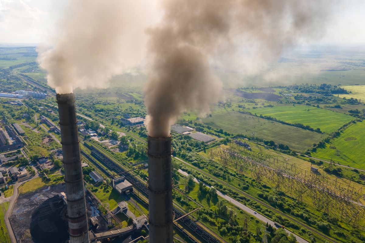
Why are seismic risk prevention systems needed in Umbria?
Umbria is one of the regions most at risk of earthquakes. It is included in zone 1, i.e., the high-risk zone, together with Friuli Venezia Giulia, Abruzzo, Molise, Campania, and Sicily. Historically, Umbria has been hit by several destructive events. Reconstructing the region’s seismic history shows us that events recur in the same areas and allows us to consider some areas more at risk than others.
Even after various reconstructions, Umbria’s historic centers boast a cultural and artistic heritage of great value, with several cities and monuments included in the UNESCO World Heritage List that must be preserved and protected.
Hydrogeological instability and urban green space management: a challenge for sustainability
Umbria, like much of Italy, is highly exposed to the risk of hydrogeological instability, a complex phenomenon that includes landslides, floods, and coastal erosion. Among these, landslides are a particularly widespread critical issue, with significant impacts on the population, towns, communication infrastructure, and the local economy.
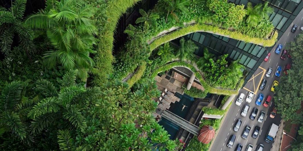
A key element in mitigating these risks is the tree heritage, an essential component of the Italian landscape. Trees play a crucial role in reducing the effects of hydrogeological instability, while also contributing to improving the environmental sustainability of cities. Various regulations and initiatives promote the increase and enhancement of urban green areas, favoring CO2 absorption and improving quality of life.
The main objective of the GAIA project is to improve the monitoring of hydrogeological instability, tree stability, and the ecosystem services provided by urban green areas. Investing in the intelligent management of urban greenery and the prevention of hydrogeological instability means creating safer, more sustainable, and more resilient cities that are capable of facing the challenges of the future.
the evolution blog

Articles
Cities of the future Roofs become “climate oases” and energy centres with the European DUT aRTes project
Cities of the future Roofs become “climate oases” and energy centres with the European DUT aRTes project From vertical farming to drone logistics: an international consortium is transforming the rooftops of European cities into [...]
Discovering Urban Greenery
What are Nature-based Solutions?
With the contribution of

Con il contributo di
Con il contributo di
Partners involved


TeamDev and WiseTown’s R&D departments are involved in the project, in collaboration with Wisepower and the University of Perugia.
organizzato da
Una mattinata dedicata alla formazione e alla condivisione, organizzata da WiseTown, divisione dedicata alla smart city della software house TeamDev, dall’Ordine dei Geometri della Provincia di Perugia, in collaborazione con l’Istituto Aldo Capitini e il Comune di Perugia.
organizzato da
Una mattinata dedicata alla formazione e alla condivisione, organizzata da WiseTown, divisione dedicata alla smart city della software house TeamDev e dall’Ordine dei Geometri della Provincia di Perugia, in collaborazione con l’Istituto Aldo Capitini e il Comune di Perugia.
The Urban Evolution Project Team

Luciano Concezzi
Agronomist and head of the R&D department

Fabio Ponte
Project Manager & Researcher

Daniele Diodati
Researcher, Artificial Intelligence

Ricarda Dziadek
Geophysicist, remote sensing specialist in the making
